
Scientist of the Day - William George Maton

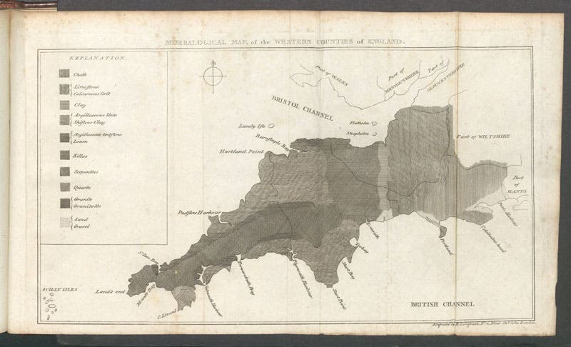
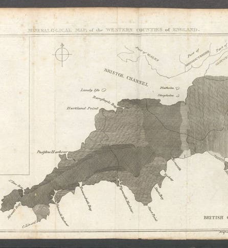
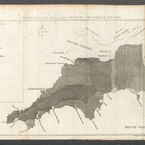
Geological map of Cornwall, Devon, Dorset, and Somerset, engraving, in Observations Relative Chiefly to the Natural History, Picturesque Scenery, and Antiquities of the Western Countries of England, by William George Maton, vol. 2, plate at end, 1797 (Linda Hall Library)
William George Maton, an English physician, naturalist, and antiquarian, died Mar. 30, 1835, at age 61. He was born in Salisbury and attended Queen's College, Oxford, where he became interested in botany, and he was invited into the fledgling Linnean Society in 1794, when he was just 20 years old.

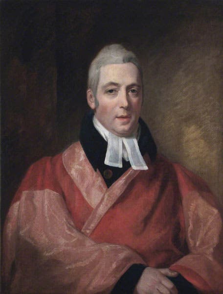
Portrait of William George Maton, oil on canvas, unknown artist and date, Royal College of Physicians, London (artuk.org)
That same year, he left on a tour on horseback of the "Western Counties" of southern England – Cornwall, Devon, Somerset, and Dorset – with two companions, one of whom, Thomas Rackett, was a competent artist. Two years later, Maton and Rackett made a second trip, visiting places they had missed the first time. In 1797, Maton published an account of their travels, titled: Observations Relative Chiefly to the Natural History, Picturesque Scenery, and Antiquities of the Western Countries of England (1797).

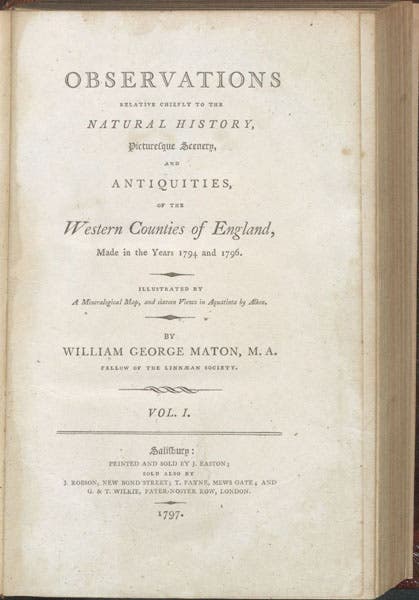
Title page, Observations Relative Chiefly to the Natural History, Picturesque Scenery, and Antiquities of the Western Countries of England, by William George Maton, vol. 1, 1797 (Linda Hall Library)
The two-volume work is best known for its 16 aquatints, made after the drawings of Rackett, by Samuel Alken, which are some of earliest scientific aquatints anywhere. Last fall, we wrote a post on Alken, where we showed four of those prints, plus three details, and we include one more here (fourth image). Maton had little to do with this aspect of the book.

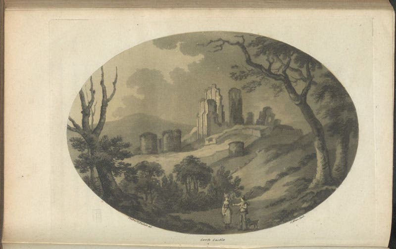
View of Corfe Castle, aquatint by Samuel Alken after drawing by Thomas Rackett, Observations Relative Chiefly to the Natural History, Picturesque Scenery, and Antiquities of the Western Countries of England, by William George Maton, vol. 1, p. 168, 1797 (Linda Hall Library)
However, there is one novel feature of Maton's book that is entirely due to Maton, and that is the geological map at the end of volume 2 (first image). It is not an aquatint, but an engraving, and it shows Cornwall, Devon, Somerset, and Dorset, from left to right. The area is overlaid with various styles of cross-hatching, for which there is a key at left, with the name of various kinds of rock, like granite, serpentine, and killas, indicating that this is a mineralogical map.

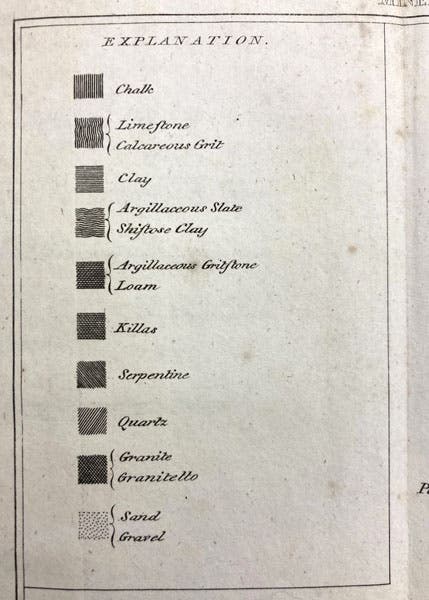
Key to hatchings for various rock types, detail of geological map, engraving in Observations Relative Chiefly to the Natural History, Picturesque Scenery, and Antiquities of the Western Countries of England, by William George Maton, vol. 2, plate at end, 1797 (Linda Hall Library)
There had been mineralogical maps before, by John Strachey in England and Jean-Étienne Guettard and Nicolas Desmarest in France, and the need for and requirements of such maps had been set down by Martin Lister back in 1683. Maton mentions most of these in the text that accompanied the map. But in Maton’s day, the tendency was to use color to denote the different formations of rock. Maton was strongly against this. In an area like Cornwall, where igneous rocks such as granite transform subtly into metamorphic rocks like serpentine and killas, identifying them with colors is arbitrary and confusing, as it does not distinguish between formations that gradually merge into one another, and those where the change is abrupt (what we would call an unconformity). Properly chosen varieties of cross-hatching will allow the geological cartographer to do that. We include details of the key to the map (fifth and seventh images), and the area near Land’s End (sixth image), so you can see how Maton cleverly managed this.

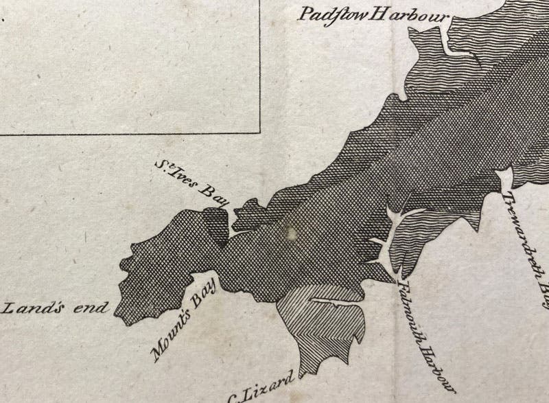
Various surface rock types in Cornwall, detail of geological map, engraving in Observations Relative Chiefly to the Natural History, Picturesque Scenery, and Antiquities of the Western Countries of England, by William George Maton, vol. 2, plate at end, 1797 (Linda Hall Library)
Maton was either unpersuasive, or unread, because when William Smith published his geological map of England in 1815, the formations were all identified by color. Probably for Smith’s map, it did not matter, as unconformities did not even show up at this scale, but Maton’s advice was valuable, nevertheless. Black-and-white geological maps, with properly chosen engraved shadings, would prove superior to color when it came to providing details of the superposition of rock formations.

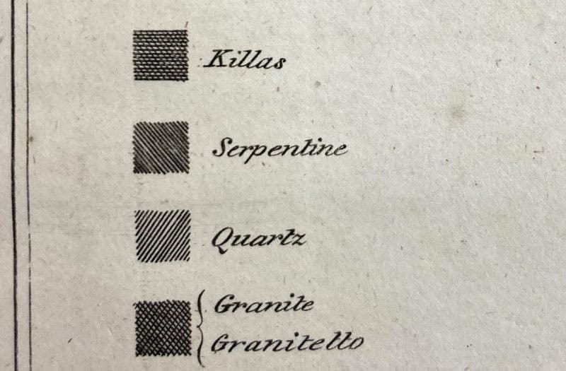
Hatchings for granite, quartz, serpentine, and killas, detail of geological map, engraving in Observations Relative Chiefly to the Natural History, Picturesque Scenery, and Antiquities of the Western Countries of England, by William George Maton, vol. 2, plate at end, 1797 (Linda Hall Library)
There was a study of Maton and his map that appeared in a Special Publication of the Geological Society of London in 2014. Surprisingly, our otherwise excellent library does not have this. I will request that we acquire it; meanwhile, here is a link to the exact citation, for those who have the GSL SP series and want to learn more (as I do).
Having made this contribution to geological mapping, at the age of 23, Maton turned to medicine, a field in which he had a significant career, with a highly regarded private practice. His further geological thoughts, if he had any, were never aired in public.
There is a portrait of Maton at the Royal College of Physicians, says ArtUK, but no one seems to know who the artist was or when it was painted. We have used it nevertheless (second image). If you cannot trust the RCP, who can you trust?
Maton was buried in Salisbury cathedral, where there is a large memorial tablet on the wall. It is not very legible at this scale, but you may try to read it here.
William B. Ashworth, Jr., Consultant for the History of Science, Linda Hall Library and Associate Professor emeritus, Department of History, University of Missouri-Kansas City. Comments or corrections are welcome; please direct to ashworthw@umkc.edu.
