Scientist of the Day - Pierre-Louis de Maupertuis

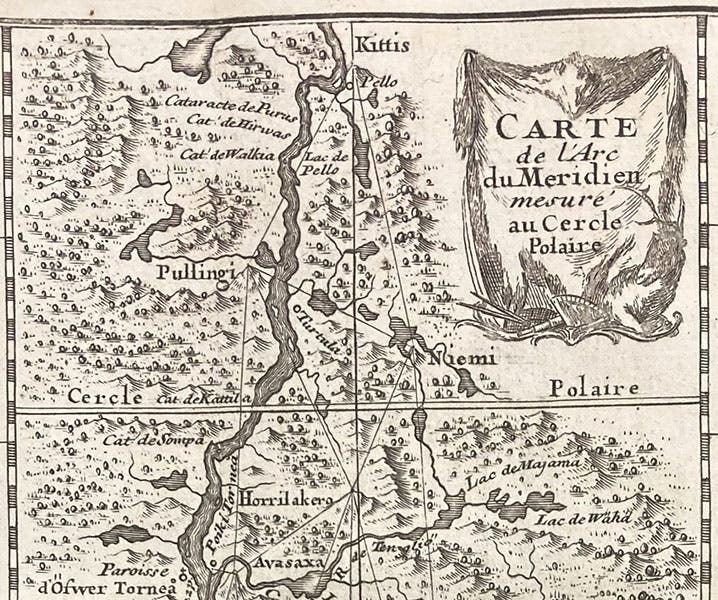
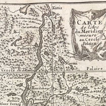
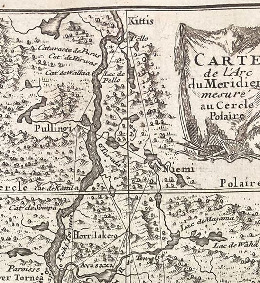
Detail of map of Lapland, showing series of triangulations made in Lapland to determine the length of a degree of latitude, La figure de la terre, déterminée par les observations de Messieurs de Maupertuis, Clairaut, Camus, Le Monnier ... & de M. l'Abbé Outhier ... accompagnes de M. Celsius ... faites par ordre du roy au cercle polaire, plate 1 at end, 1738 (The Linda Hall)
Pierre-Louis Moreau de Maupertuis, a French mathematician and natural philosopher, died on July 27, 1759, at the age of about 61. Maupertuis was highly regarded for his mathematical abilities as well as his social suavity in Parisian salons. He was accepted into the Royal Academy of Sciences in Paris when he was only 27, and in 1740, Frederick II of Prussia invited him to come to Berlin to become President of the Academy there, and Maupertuis accepted. Leonhard Euler was there at the time.

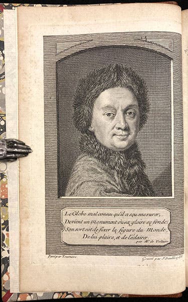
Portrait of Pierre-Louis Moreau de Maupertuis, frontispiece engraving by J. Daullé, after Robert Levrac-Tourniéres, Oeuvres de Mr. de Maupertuis, vol. 1, 1756 (The Linda Hall)
During the 1730s, Maupertuis formed close friendships with Madame du Châtelet, and her lover, Voltaire, both of whom had become ardent supporters of Newtonian natural philosophy, preferring its mathematical exactness to the qualitative Cartesian science then still in vogue in most of France. Maupertuis was inclined toward Newtonian explanations himself, which is probably why the three got along so well, at least at first. They had a falling out later, after Maupertuis went to Berlin, and Voltaire wrote a vicious satire ridiculing Maupertuis, which caused Maupertuis great distress – he was a very proud man. But he also developed a close friendship with Alexis Clairaut, an even more brilliant mathematician than Maupertuis, and that friendship would last.

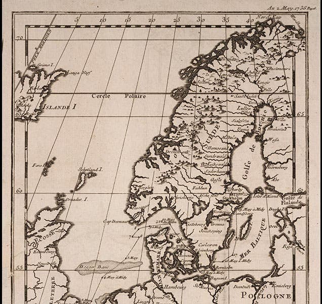
Map of Scandinavia, with the Gulf of Boothia jutting up into Lapland, where Maupertuis’ expedition made their measurements, engraving in Journal d'un voyage au nord, en 1736. & 1737, by Abbé Reginald Outhier, 1744 (The Linda Hall)
Many years ago, I wrote my first post on Maupertuis, and for reasons that now escape me, I discussed only the two printed editions of his little book, Discours sur les differentes figures des astres (Discourse on the different figures of stars; 1732 and 1742) and the mezzotint frontispiece that adorned the 1742 edition. It was an interesting post, in my opinion, but it did not begin to describe the major achievements of Maupertuis's professional life. So on this anniversary, we have already begun to expand the scope, and we will continue to do so by discussing one of the high points of his career, the expedition to Lapland in 1736-37, to measure the length of a degree of latitude along the Arctic Circle, just north of Sweden.

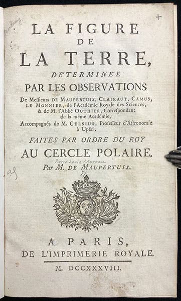
Title page, La figure de la terre, déterminée par les observations de Messieurs de Maupertuis, Clairaut, Camus, Le Monnier ... & de M. l'Abbé Outhier ... accompagnes de M
From 1720 on, the Paris Academy and the Paris Observatory had become obsessed with determining the shape of the Earth. It was evident that the Earth was not a perfect sphere, but was it slightly elongated, like a lemon, or a little flattened, like an onion? Isaac Newton had calculated that a rotating Earth must flatten slightly at the poles (becoming oblate) due to centrifugal force. René Descartes had made no such predictions, but the Cassini dynasty, ardent Cartesian astronomers all, thought the Earth was elongated at the poles, or prolate. It was soon realized there was a way to physically determine the shape of the Earth. On a perfect sphere, every degree of latitude or longitude is the same size. But if the Earth is oblate – flattened at the poles – then the length of a degree in miles will increase as you travel north, being smallest at the Equator. Since the length of a degree in Paris was more-or-less well known, all the Academy had to do was send a geodetic team to an equatorial area – Ecuador would do nicely – and measure the length of a degree and compare it to the figure for Paris. So the Academy put together a geodetic expedition to Ecuador and sent them off in 1735. The scientists included Pierre Bourguer, Charles Marie de La Condamine, and a Spaniard, Jorge Juan y Santacilia, and his colleague, Antonio de Ulloa. We have written a post on each, which together should inform you about the activities in Ecuador.

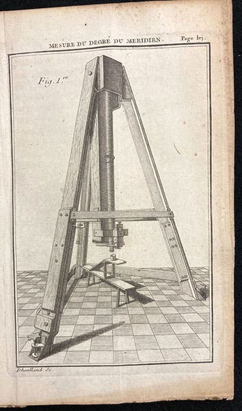
Zenith sector, built by George Graham for Pierre de Maupertuis, engraving, Dégré du méridien entre Paris et Amiens, déterminé par la mesure de M. Picard, et par les observations de Mrs de Maupertuis, Clairaut, Camus, Le Monnier, de l'Academie Royale des Sciences, p. lvi, 1740 (The Linda Hall)
Immediately after the equatorial expedition departed, Maupertuis proposed another geodetic survey, this time to the Arctic Circle, with himself as leader. He argued that a third set of measurements would provide unequivocal evidence as to whether the length of a degree got bigger or smaller as one went north. Privately, he did not trust the Paris measurements, since they were made by the Cassini family, and the instruments they used were crude, in his opinion.
Maupertuis was very persuasive, and the King's financial ministers came up with the funding. It was even agreed that Maupertuis would be in charge, even though he had no experience as surveyor or as a leader of men. It probably helped that Clairault agreed to come along – everyone agreed that if mathematical expertise were required, Clairaut could provide it. Maupertuis also included Abbé Reginald Outhier, a skilled surveyor, and Pierre-Charles Le Monnier, an astronomer, and in a moment of inspired genius, he asked Anders Celsius, a Swede, to take part. Not only could Celsius help them make their way through Sweden, but Celsius had contacts with instrument makers in England, and he could – and did – order zenith telescopes, transit instruments, and pendulum chronometers from the best craftsmen in the world, including George Graham.

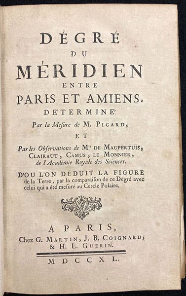
Title page, Dégré du méridien entre Paris et Amiens, déterminé par la mesure de M. Picard, et par les observations de Mrs de Maupertuis, Clairaut, Camus, Le Monnier, de l'Academie Royale des Sciences, 1740 (The Linda Hall)
The post on Outhier provides a good description of how and where the Lapland team made their measurements. The Lapland expedition lasted 18 months (the Ecuadorean adventure would take 9 years); in 1738, Maupertuis published the initial results in a book, La figure de la terre, déterminée par les observations de Messieurs de Maupertuis, Clairaut, Camus, Le Monnier ... & de M. l'Abbé Outhier ... accompagnes de M. Celsius (1738; fourth image), revealing that a degree of latitude was greater in Lapland than in Paris, and so the Earth was oblate, as Newton had predicted. Jacques Cassini would have none of this, assailing Maupertuis's abilities as a geodesist and claiming improper alignment of the celebrated zenith sector. Maupertuis published a second treatise in 1740, Dégré du méridien entre Paris et Amiens, déterminé par la mesure de M. Picard, et par les observations de Mrs de Maupertuis, Clairaut, Camus, Le Monnier, de l'Academie Royale des Sciences (sixth image), which Cassini found even more objectionable, since Maupertuis and his colleagues essentially redid his Paris measurements. It wasn't until the Ecuador team returned in 1744, with measurements showing that a degree in Ecuador was smaller than that of Paris and Lapland, that it was generally conceded that Maupertuis and his team had done their job well, and the oblateness of the Earth was accepted. We have both of Maupertuis's books on the Lapland expedition in our collections.

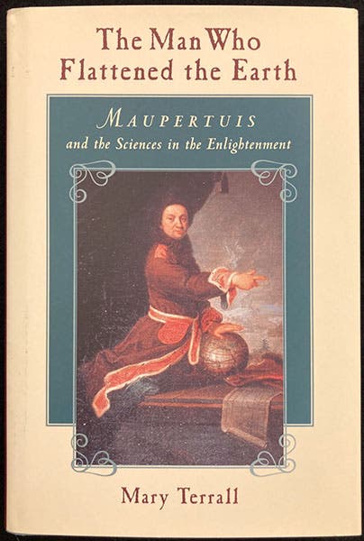
Dust jacket, The Man Who Flattened the Earth: Maupertuis and the Sciences in the Enlightenment, by Mary Terrall, 2002 (author’s copy)
There is an excellent book by Mary Terrall, The Man Who Flattened the Earth: Maupertuis and the Sciences in the Enlightenment (2002) that has two chapters on the Lapland expedition. The dust jacket of the book (last image) reproduces an oil portrait of Maupertuis, painted by Robert Levrac-Tourniéres in 1740, that shows Maupertuis literally flattening the Earth with the palm of his hand. The portrait is in the Musée of Saint-Malo, Maupertuis’s home town.
Maupertuis was also the author of a important principle of physics known as the Principle of Least Action, and he is regarded by some as an important pre-Darwinian voice on inheritance and natural selection. So discussion of Maupertuis may continue in a third post some day.
William B. Ashworth, Jr., Consultant for the History of Science, Linda Hall Library and Associate Professor emeritus, Department of History, University of Missouri-Kansas City. Comments or corrections are welcome; please direct to ashworthw@umkc.edu.